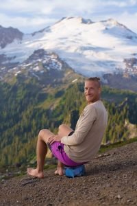
When I hear someone talk about campervans I picture an old VW, surfboards on top, parked next to the beach. In reality my first camper van experience turned out to be a rented Dodge minivan named Rae Rae. Okay not my dream van adventure, there was no surfing or beaches but I explored national parks and stood under giant trees, still having a blast campervanning California.

My girlfriend Emma, and I just said goodbye to her father at the San Francisco airport and the two of us had a little under two weeks before needing to be in San Diego to meet more of Emma’s family. Staying in San Fransisco was out of our budget, so we spontaneously decided to rent a campervan to see more of California.

Why did we rent from Lost Campers
There are a handful of camper van rental companies in California so why did we choose Lost Campers?
- They had the best rental rate, cost was the first thing Emma and I looked for, every other rental company wanted $10 – 20 USD more per day after taxes and fees.
- Their vans are not brightly painted or plastered with logos. If you are sleeping somewhere in a city or parked for the night alongside the road you blend in like a normal vehicle. Most other companies have vans that are brightly painted and wrapped with logos to get attention, which works, because you can definitively spot them on the road. (I prefer to stay hidden)
- We were looking to rent the van one way from San Francisco to Los Angeles. Every rental company charges a one way fee but Lost Campers had the lowest fee of $100 USD compared to $150 that other companies were charging.
Our total cost for 10 nights, with the one way fee, taxes and insurance was $662. Pricey for a backpacker budget but still cheaper than a hostel in California and split between the two of us it would not completely overkill our budget. And being mobile allowed us to see way more of California than if we stuck to just the Greyhound or Amtrak.


Beware, every rental company has the same downside, you are only allowed 100 free driving miles per day but you are able to “buy” more mileage. You can drive over 100 miles one day and less the next as long as your total mileage does not go over your total number of rental days. If you go over you will be paying for each and every extra mile.
Wild Tip: 100 miles might sound like a lot but it truly is not. That is only a couple of hours driving and California is not a small state. If you include the distances inside and around each national park you defiantly have to watch your limit.

We had a great experience with Lost Campers. The staff was friendly and their vans are mostly newer models. All of the vans come with a full kitchen, stove burners, a cooking set, wash sink, table with lawn chairs, a cooler and bedroom set of pillows and blankets.
The in van bed folds out and has a comfortable, thick mattress. When folded up you have a bench and table. The van also had privacy curtains for all the windows and for free Lost Campers gave us extra sleeping bags in case we needed them.
If you want to check around, the main rental companies besides Lost Campers are Jucy Camper vans, Escape Camper vans, Wicked Campers and a smaller company called Bongo Buggies.

On the road
We picked up Rae Rae and immediately decided to head across the Bay Bridge out of San Francisco. Being a spur of the moment idea we did not plan ahead or book anything and I just quickly looked for a route that would save us mileage. The shortest route was to head to the northern entrance of Yosemite National Park. We would enter the park at the Big Oak Flat entrance then go north to see Hetch Hetchy and make our way down to Yosemite Valley. From there we figured we could continue south to Kings Canyon & Sequoia National Park before heading west to drop off the van in Los Angeles.

After a full day getting the van, supplies, running errands and driving we were now in the mountains with no cellphone reception, no place to stay and did not really want to spend our first night parked on the side of the road. Just as we were about to stop and park we came across Yosemite Pines Resort and pulled in. The office was closed but they had an after hours box with a list of available camping spaces. Picking a slightly level one for Rae Rae we cooked and set up the van by the light of our headlamps.


Talking to the camp host the following morning I found out that Highway 120, the only road from Big Oak Flat entrance south to Yosemite Valley was closed due to storm debris and damages. We weren’t even to the park yet and we would have to backtrack, yay for limited mileage. I also found out that even in March, California’s national parks are busy. Our current campsite had WIFI and as I looked for camp sites in Yosemite Valley, almost all of them were full, I found only one spot with two consecutive days and I booked it straight away.

Hetch Hetchy
Located 16 miles from Yosemite’s Big Oak Flat entrance, Hetch Hetchy is a fresh water reservoir and home to the O’Shaughnesse Dam that provides water to 2.4 million Bay Area users.


Hetch Hetchy is the least visited area of Yosemite National Park with less than 25,000 visitors annually. Entry is free and this part of the park is only open to visitors from 8am to 5pm. A back country permit is need to stay the night in either the small campground or in the back country.

It sits at the lowest elevation in Yosemite National Park, allowing the hiking trails to be opened first and stay open longer. Perfect for early spring and late fall. Also with the decreased elevation Hetch Hetchy has warmer winter temperatures, making snowshoeing a popular activity. I found the O’Shaughnesse Dam to be quite impressive and it is easy to spend a couple of hours wandering around, enjoying some of the shorter hikes. The Tueeulala and Wapama waterfalls flow nicely in the the spring and are easily accessible.


Yosemite Valley
The main way to enter Yosemite Valley is via Highway 140 and the El Portal road. The El Portal road splits into individual one ways that create a loop around whole valley where you are surrounded by forest and wind alongside a steady river before El Captain dominates your view.


We stopped almost directly after entering the park to take photos of El Captain. Unable to contain our excitement we decided to walk the Bridalveil Falls trail, directly next to where we parked. The Bridalveil Falls trail is an easy 30 minute walk where you can get up and close to see the flowing 620ft tall waterfall!

Spring is the best time to see all of Yosemite’s waterfalls flow, with peak flow rate around May. The main waterfalls like, Yosemite Falls, Sentinel Falls, Ribbon and Horsetail fall will only last until late June or early July before drying up. If you can’t make it in spring a lot of the smaller, but still massive, waterfalls last year round. When we arrived in March the snow pack was still thick in the mountains but it had recently been warm enough that the waterfalls were flowing quite nicely.


After our Bridalveil hike we continued further into the Valley. We were constantly in awe now driving passed Half Dome and Yosemite Falls. Needless to say everything in Yosemite National Park is massive and Yosemite Falls are no exception, a two stage behemoth waterfall, falling 2,425 feet to the valley floor.

The Upper Pines Campground is where we made our home for two short nights. With our time constraints and me still healing my foot from a previous injury we did not unfortunately get to tackle any of the more strenuous hikes but we did manage to tackle one small trail.

The Vernal Fall trail – This trail follows the beginning of the massive 200+ mile John Muir trail before diverging towards Vernal Falls. It starts at the Happy Isles trail head (park shuttle stop #16) and continues on for 1.2 miles with a 1,000 foot elevation gain before arriving at the base of the waterfall. This trail is all uphill but it follows a paved walking path before ending with 600 soaking wet granite steps. The hike is definitely worth the effort. I also became envious along the way, meeting groups and individuals who told me of their time spent camping along the John Muir trail.


Kings Canyon National Park
With winter roads closed past Yosemite Valley we had to backtrack on the El Portal road towards the town of Mariposa and then make our way south to Fresno before going east along Highway 180 to Kings Canyon National Park. We arrived couple of hours before dark at the General Grant campground, a first come first serve campground and the only campground open this time of year.

The stretch of road from the foothills of the Kings Canyon National Park to our campground are steep and full of switchbacks, with a massive elevation gain of over 5,000 feet. With the increased altitude the weather shifted drastically, our final hour of driving was in dense fog next to snow filled ditches.

Being at such a high elevation the lingering winter snow kept the park trails and roads closed. This greatly restricted what we could see and do in Kings Canyon National Park. It also meant that from here we could not get directly to Sequoia National Park. We would once again have to leave a park, descend a mountain and backtrack before going into another park via a different route.


The only thing open in Kings Canyon National park was the General Grant Grove, which is a short trail through a very old sequoia grove. The General Grant Tree also called the Nations Christmas Tree is the main highlight standing at a massive 260 feet tall with a base of over 100 feet around. It is amazing that you have this one extremely massive tree that is surrounded by other slightly less massive trees, which all make you feel small in comparison.


Our campsite only had 2 other crazy campers and as soon as nightfall came the weather thought it would be nice to sleet for an hour before dropping snow. The next morning we awoke early and were surrounded by 3 heavy, wet inches of snow.

At the park visitor center we found out that all the roads inside the park were closed due to snow and ice. Not only that but if the roads did not melt off today we would be stuck in the park for a few days. The weather forecast called for 4 days of straight snowfall, which did not please us or the park ranger. The park ranger didn’t want to get stuck over the weekend and we did not want to get stuck there at all.
Luckily after few hours in the visitors center the ice and snow did melt off enough for the park entrance to be opened but with the restriction of chains or 4 wheel drive. Seeing vehicles similar to ours arrive to the visitor center we decided to put Rae Rae to the test. It was slow going but once we got lower in elevation everything was fine.

Sequoia National Park
Just passed the town of Three Rivers we stopped into the Three Rivers Hideaway to inquire if they had camping available, just in case we did not want to spend the night in Sequoia National Park. With our recent experiences we knew that the odds were good that it would be snowy inside Sequoia National Park.

Making our way to the national park, the worst part of our drive was not the switchbacks or weather, it was the traffic. We were not by any means speeding up the mountain but we got stuck behind a few rental cars that were going very, very slow. Eventually we made it to the Giant Forest, home of the General Sherman tree, the largest living single stem tree on Earth, standing at a massive at 275 feet tall with a circumference of almost 103 feet at its base.

The Giant Forest seemed like a mystical place with the ground covered in snow and a layer of dense fog surrounding the tops of the trees…until you looked straight ahead and saw dozens of tourist, most of which were hopping the do not cross fences to lean against trees for a selfie.


It would have been nice to do more trails and wander further but once again most of the roads in this national park were closed due to snow. We planned on camping at the Potwisha campground which was halfway to the Giant Forest but it was cold, snowy and only 30 minutes away from the Three Rivers Hideaway so we took the easy choice and continued out of the park to enjoy warmer temperatures.

Last Days
Each national park we visited in California was massive in a size I had never seen before, from giant granite cliffs to giant trees and waterfalls. The great thing was that every national park had a different distinctive environment and we did not even scratch the surface of these natural wonders. Unfortunately we were almost out of time and low on miles so we had to say goodbye to the national parks and head towards Los Angeles.

Final Thoughts
All in all renting a camper van was the best thing we could have done when exploring California. We got to see more nature than we would have otherwise and I always enjoy a good road trip! I hope you like my Campervanning California post and if you would like to read more about my time in California please visit my Destination California page.

 Social

If you find this post to be pretty wild, please share it with some friends (or strangers) and make sure to connect with @Outsidevibes on our social media.
Affiliate
Planning your next adventure? This page contains affiliate links to some of the best backpacking resources available. It would be cool if you visited from here so I might get a super small commission, at no additional cost to you. Cheers!
Sleep Well, Save Money, Make Friends


Stay Safe, Fly Cheap


Snag Great Gear